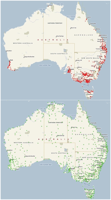
Figure 1. Location of dairy farms for which milk production data was retrieved and location of weather stations providing climate data.
A. Location of dairy farms and B. Location of weather stations (green pins) supplying data in 2008 to the Australian Bureau of Meteorology (http://www.bom.gov.au/silo) that were in turn used by the Queensland Department of Environment and Resource Management DataDrill project (http://www.longpaddock.qld.gov.au/silo) in interpolating meteorological data onto a 5-×5-km grid across Australia. Image created with using http://www.microsoft.com/maps/isdk/ajax/ .

