
Figure 2.
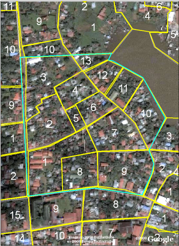
Example of Printed Satellite Map for Data Collection in Neighborhood Beholden. Public health workers mark maps like this printed in black and white on 8.5 × 11 inch paper to denote the location of potential larval development sites during their routine epidemiologic surveillance. Each neighborhood block is denoted with its corresponding number.