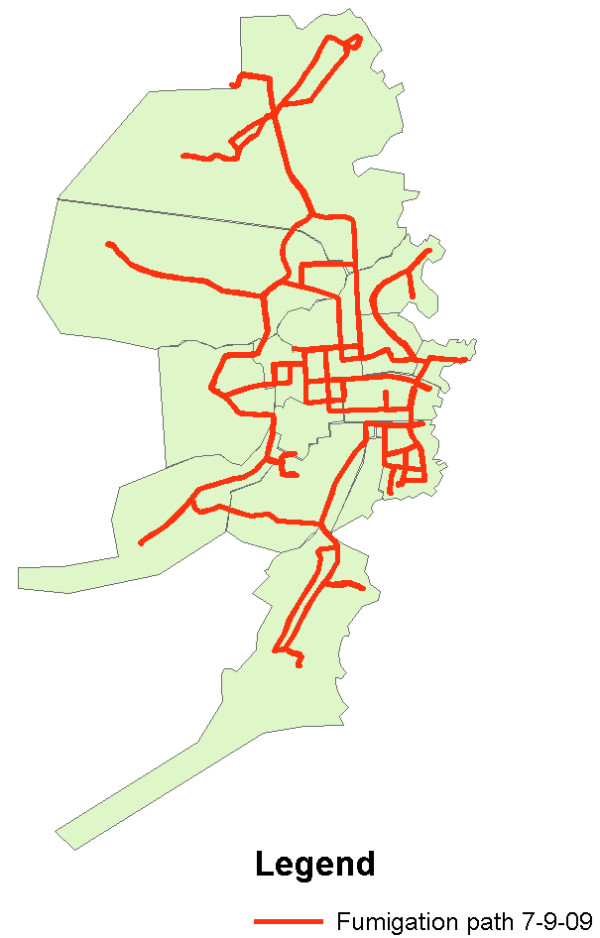
Figure 7.

Emergency Spatial Fumigation performed on 7/9/09 during a Dengue Epidemic. This map was constructed using the track function on the GPS unit to collect information on the path taken by the fumigation truck as it drove through areas of Bluefields. The map was then sent to the Ministry of Health in Managua to communicate the activities of the day and plan for control interventions for the following day. This map also demonstrates areas that cannot be reached by truck as the streets are two narrow. These areas are of particular risk as both the fumigation truck cannot enter and the garbage truck does not enter. Therefore, further resources are needed to send public health workers into these neighborhoods to fumigate with handheld devices, to clean up garbage, and to educate people about the importance of carrying their garbage out to a site where the garbage can be properly disposed of.
