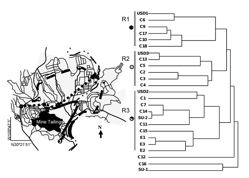
Figure 4.
A) Contour map based on cluster analysis. The short dashed line connects samples sites from Cluster R1, the solid line connects sample sites from Cluster R2, and the long dashed line connects sample sites from Cluster R3. B) Dendrogram resulting from the Ward's method of hierarchical cluster analysis for the 25 soil samples and the 11 metal(loid)s. Three major clusters (R1, R2, and R3) were identified and labeled with a symbol that corresponds to their location on the map.

