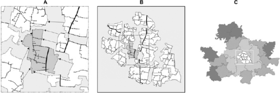
Fig. 3.
Stage 2—Joining the digitized maps into a basemap
(A) Adjacent digitized local-area maps are molded to the central (anchored) map (darkly-shaded area, from Fig. 1) using rubbersheeting points (arrows) from each local-area map. (B) The digitized local maps are rubbersheeted into a single map of an administrative union. Paved road ( ); Dirt road (
 ). (C) Repeating this process for each union, the resulting union maps are rubbersheeted together into a single basemap of the JiVitA project area, beginning from the centre and working outward (indicated by darker levels of shading)

