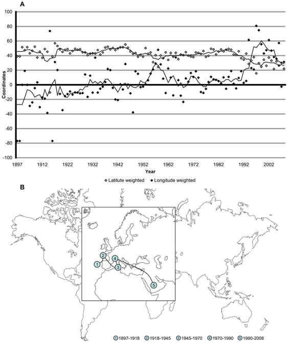
Figure 2. Geographical analysis of WR.
A. Yearly longitude and latitude of the WR from 1897 to 2008. Coordinates are angular measurement in degree. B. The path of the barycenter of WR from 1897 to 2008. For 5 historical periods, the average barycenter is calculated:  (42°31′, 14°31′),
  (47°26′, 2°53′),
  (41°13′, 7°15′),
  (44°01′, 5°09′),
  (31°10′, 37°17′), respectively (latitude, longitude).

