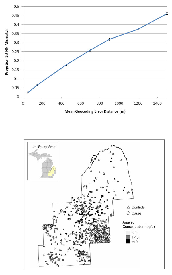
Figure 8.
Proportion mismatch of first nearest neighbors versus mean geocoding error distance (meters) (top) for a study of bladder cancer cases in Michigan (map, bottom). Each point represents the mean of 10 simulations on the observed locations (~500 points). The confidence intervals shown are +/- one standard error from 10 randomizations. Bladder cancer map (bottom) from [22], case locations perturbed to protect participant privacy.

