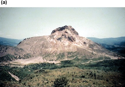
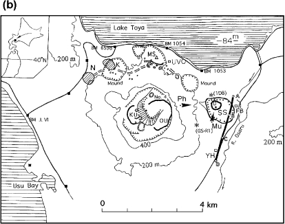
Fig. 1.
(a) The 1944 Usu lava dome and mound (Showa-shinzan) seen from the eastern rim of Usu (Ph in the bottom figure) as of 1958. (b) Topographic sketch map of Usu as of 2002. Thick contours show lava domes and contours with dots volcanic mounds. SS; the 1944 lava dome, D; top of the SS dome, MS; the 1910 mound, KU; the 1769 lava dome, OU; the 1853 lava dome. (GS-R1), (1D8); boreholes, K and N; explosion areas of the 2000 eruption. A thick line A-B-C-D shows the route of precise levels. Mu shows the location of the muon detector.


