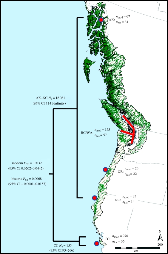
Figure 1.
Historic (pre-European settlement; hatched areas) and current (green areas) distribution of potential murrelet nesting habitat in northwestern North America. The map of the distribution of murrelet habitat from Oregon to Alaska was developed by Inforain's rainforest mapping project (http://www.inforain.org/rainforestatlas/rainforestatlas/page4.html), and the distribution of murrelet habitat in California was developed by Fox (1996). Also depicted are sample sizes for genetic analyses (nmod = modern sample size, nhis = historic sample size), estimates of effective population size (Ne), and estimates of genetic population differentiation (FST) for marbled murrelets (B. marmoratus) sampled at five locations (solid red circles and red line) during both modern (1997–2007) and historic (1888–1940) sampling periods. Sampling locations included southeast Alaska (AK), British Columbia/Washington (BC/WA), Oregon (OR), northern California (NC) and central California (CC).

