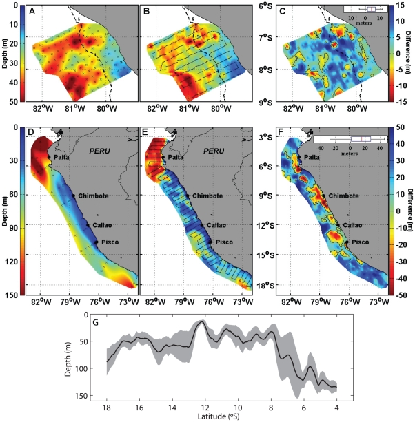
Figure 2. Spatial distribution of the upper OMZ depth.
Upper OMZ depth estimated from Z0.8 determined from CTDO measurements (A) and Niskin bottles profiles (D) and ZVEEC estimated from acoustic measurements (B, E). Black crosses indicate the position of hydrographic stations (A, D) whereas black lines indicate acoustic tracks (B, E). C and F differences between Z0.8 and ZVEEC; black contours correspond to a null difference; boxplots of the differences are displayed on the upper right part of (C) and (F). Upper panel (A, B, C) corresponds to the ‘Filamentos 2008’ survey; dotted lines indicate the depth of the 200 m bottom depth. Lower panel (D, E, F) corresponds to the ‘Pelagic 2005’ survey. Left colour-bars correspond to figures (A, B, D, E) while right colour-bars correspond to figures (C, F). G. Meridional variation of ZVEEC averaged between the coast and 200 km offshore during the ‘Pelagic 2005’ survey (black solid line) and corresponding ± one standard deviation (grey shaded area).

