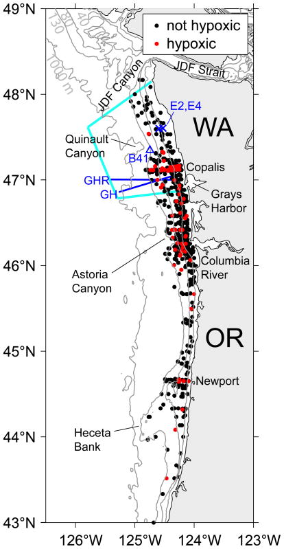
Figure 1.
Bathymetry of the Washington (WA) and Oregon (OR) continental shelf region. The 40, 80, 130, and 1000 m isobaths are shown. The blue triangle indicates the location of NDBC wind buoy 46041 (B41). The blue x’s indicate locations of the E2 and E4 moorings. The GH and GHR hydrographic lines are shown as solid blue lines. Light blue lines enclose the study region on the Washington shelf. Also shown are the locations of historical near-bottom (10 m from bottom or less, 130 m bottom depth or less) stations for the Washington and Oregon continental shelves. Historical observations of near-bottom hypoxia are red; all others black.

