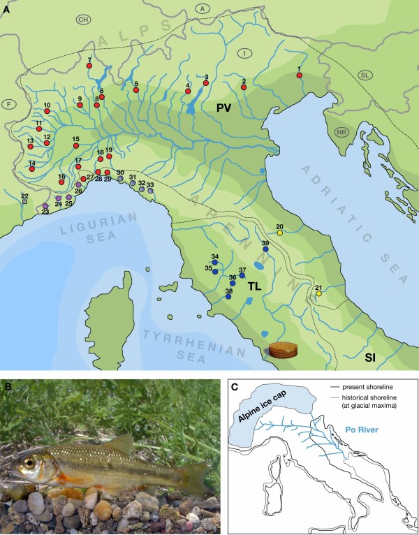
Figure 1.
The vairone in Italy. (a) Map of northern and Central Italy showing the main river systems, the ichthyogeographic districts and the sampling sites. Numbers (and colors) of the sampling sites correspond to Table 1 and Fig. 2. Note that population 22 consisted of specimens of Telestes souffia, the sister species to T. muticellus, and was excluded from some of the analyses. (b) The Italian vairone (Telestes muticellus). (c) During glacial maxima, the Alps were covered by an ice cap and sea levels were markedly lowered; the estuary of the Po River system, which also included rivers that today directly drain into the Adriatic Sea, was situated at the Middle Adriatic pitch. PV...Padano-Venetian ichthyogeographic district; TL...Tuscano-Latium ichthyogeographic district; SI...South Italian ichthyogeographic district.

