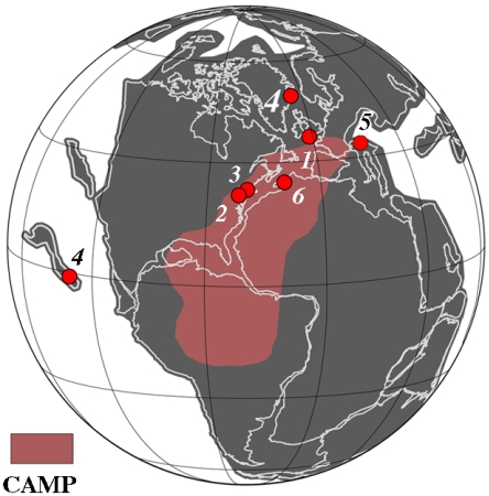
Fig. 1.
Map of Pangea at 201 Ma showing the distribution of the CAMP and the localities discussed in the text: 1, St. Audrie’s Bay; 2, Newark basin; 3, Hartford basin; 4, Kennecott Point; 5, Val Adrara; 6, Moroccan CAMP sections. Base map (orthographic projection) courtesy of C. Scotese based on the latitudinal positions of ref. 14.

