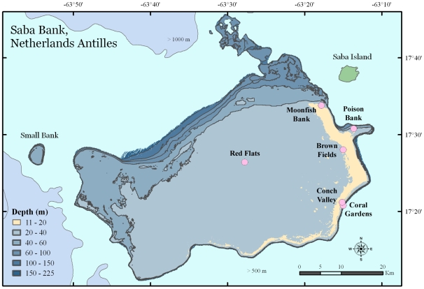
Figure 1. Map of Saba Bank, Netherlands Antilles.
Saba Bank is shown relative to its nearest neighbor, Saba Island. A pale band of color representing a “reef crest” at 11 to 20 m depth extends 50 km along the east and southeast perimeter of the Bank. Circles indicate the locations of sponge biodiversity surveys in 2006.

