
FIGURE 1.
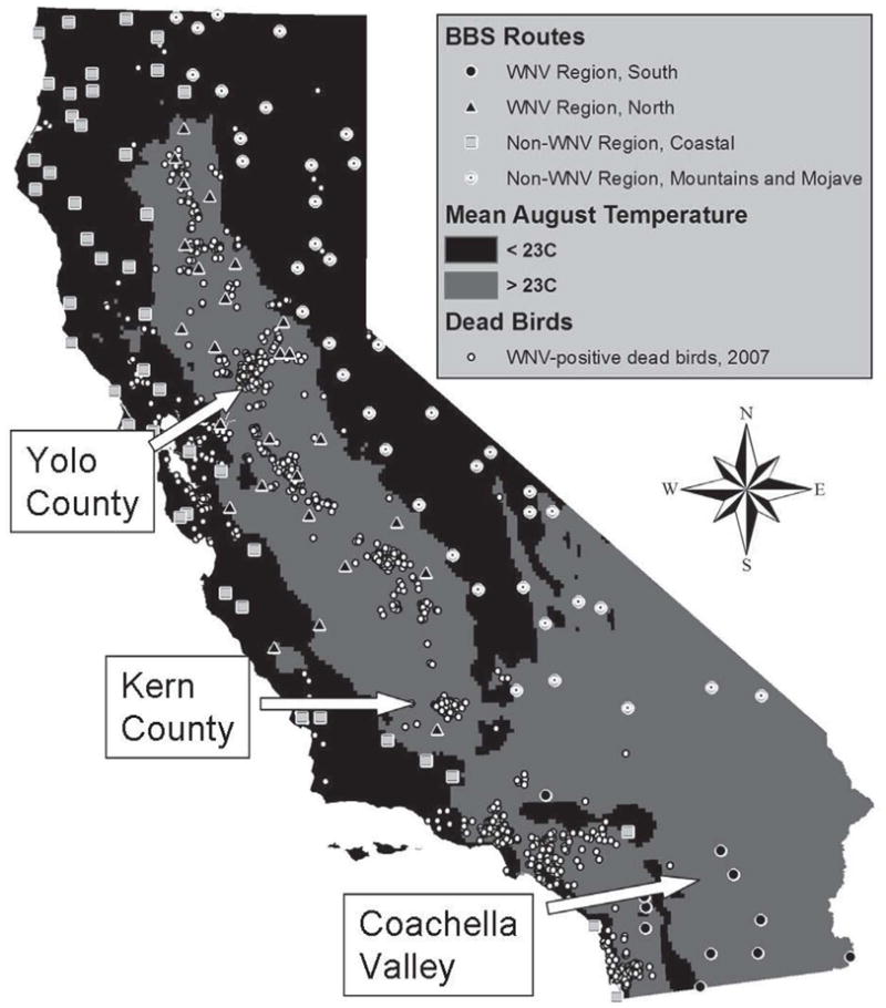
Locations of Breeding Bird Survey routes, coded by region, and West Nile virus-positive dead birds found during 2007. The BBS routes are apportioned among four regions: south WNV region, average August temperatures ≥23°C south of the Tehachapi Mountains; north WNV region, average August temperatures ≥23°C north of the Tehachapi Mountains; low-temperature coastal region, coastal areas with low WNV activity and August temperatures <23°C; mountain and Mojave region, mountains and high-elevation deserts with average August temperatures <23°C or low WNV activity due to few mosquitoes. Arrows show the areas where free-ranging birds were sampled for antibody prevalence: Coachella Valley, Kern County, and Yolo County.