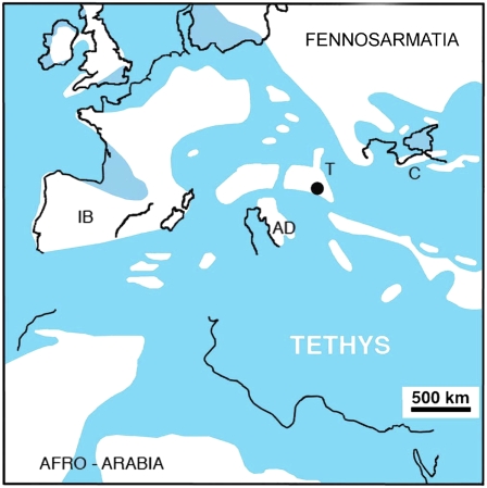
Fig. 1.
Reconstructed paleogeography of the European archipelago in the western Tethys and adjacent regions during the Maastrichtian, with selected present day coastlines superimposed to facilitate orientation. Simplified from refs. 10 and 14. White areas denote land. Black circle indicates position of Haţeg region. AD, Adriatic-Dinaric Platform; C, Crimea; IB, Iberia; T, Tisia-Dacia Block.

