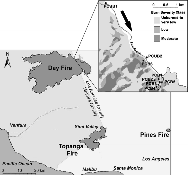
Fig. 1.

Locations of the Topanga, Pines, and Day Fire study areas. The inset map shows locations, burn severity, and proximity to surface waters for the Day Fire sampling sites. A California Department of Water Resources (CADWR) stream gage is located at the confluence of Piru and Buck Creeks. Piru Creek flows into Pyramid Lake reservoir 3.2 km below the confluence (arrow indicates flow direction)
