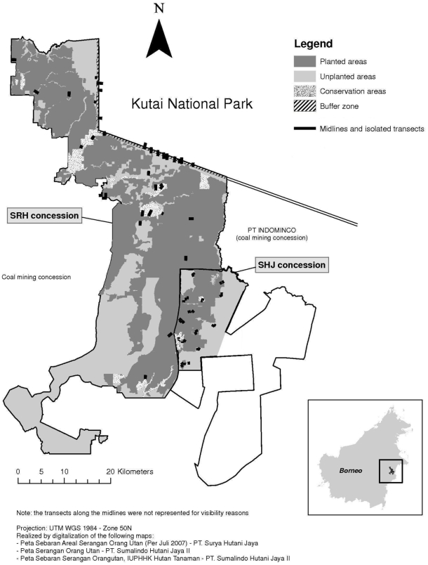
Figure 1. Study area.
Map of the study area showing the two plantation areas and the adjacent Kutai National Park and its location in the east of the island of Borneo. Black lines indicate the location of the midlines in the SRH planted, unplanted and conservation areas, and non-randomly placed transects in other parts of the two plantations as well as the buffer zone with Kutai National Park.

