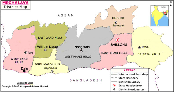
Figure 1.
District map of Meghalaya state showing interstate border with Assam to the North, and international border with Bangladesh to the South. The symbol (black dot) denotes geographical location of Dalu in the West Garo Hill district close to Bangladesh. Inset is a map of India showing location of the state of Meghalaya.

