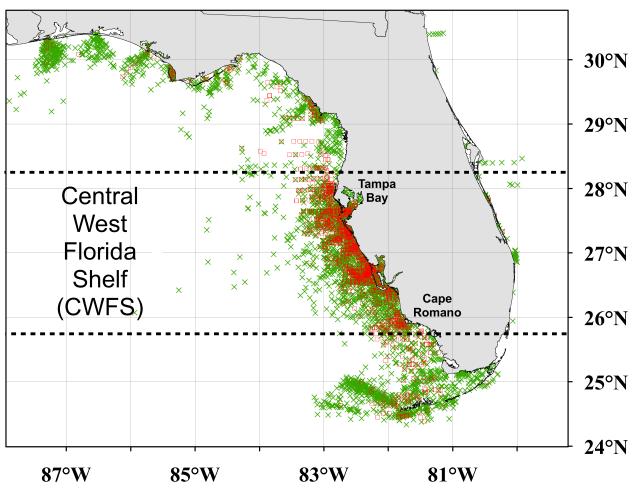
Figure 1.
Florida Harmful Algal Bloom Historical Database (2002 to 2006; data provided by the Florida Fish and Wildlife Conservation Commission’s Fish and Wildlife Research Institute; Haverkamp et al., 2004). “Identified in situ samples to be considered” (see Figure 2) illustrating the sampling location for Karenia brevis: red tides (≥1.5×10 4 cells l−1; “□”) and non-blooms (<1.5×10⁴ cells l−1; “×”). The region of the Central West Florida Shelf (CWFS – south of 28.25°N close to Tampa Bay and north of 25.75°N near Cape Romano) is indicated.

