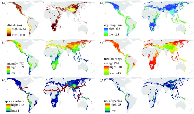
Figure 1.
Maps summarizing current and projected geographical and ecological patterns within montane regions globally. (a) Terrestrial areas occurring above 1000 m in altitude. Within these areas, (b) the projected IPCC A2 temperature anomaly between 1980–1999 and 2080–2099, (c) species richness of montane birds (n = 1009; realm boundaries delineated by red lines), and (d) average log geographical range size (lateral range extent) of montane birds. (e) Median per cent change in range size for montane birds and (f) the number of montane birds projected to lose 50% or more of their range resulting in range sizes less than 20 000 km2 under the no-dispersal (ND) scenario. All maps, except for (a), which is at 1 km resolution, were summarized within an equal-area grid with a cell area of 3091 km2. Colour ramps use Jenk's natural breaks classification.

