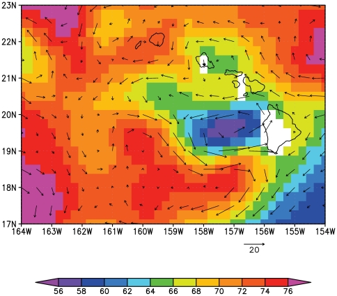
Figure 3. Sea surface height (cm, colors) as observed by satellites and the geostrophic velocity (cm/s, vectors) derived from satellite altimetry and averaged over the larval dispersal period of the four documented offspring shown in Figure 2 .
The cyclonic eddy is indicated by low sea surface heights and anti-clockwise rotation west of the Island of Hawai'i.

