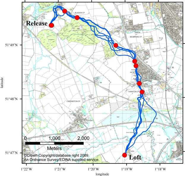
Figure 2.
Case study of the landmark identification algorithm for a single bird released at the Bladon Heath site. The five flight trajectories used for classification are shown (blue lines), along with the 10 identified landmarks (red circles). Identified landmarks occur preferentially at the boundaries of forests and villages, in addition to the release point and the loft.

