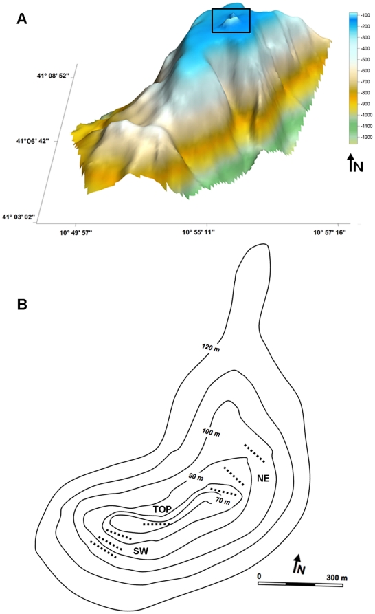
Figure 2. Topography of the Vercelli Seamount.
a) Three-dimensional map of the Vercelli Seamount showing on its top the rocky pinnacle explored with the ROV (black rectangle). b) Bathymetric map of the studied peak (60–100 m depth) showing the position of the seven video-transects on the TOP and along the NE and SW flanks.

