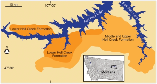
Figure 1. Index map of the Upper Cretaceous Hell Creek Formation along Ft. Peck Lake in northeastern Montana, USA.
Contiguous outcrops are traceable over an area of about 1000 square km adjacent to Fort Peck Lake shown in blue. Dark orange represents the lower Hell Creek Formation and light orange represents the middle and upper Hell Creek Formation. The enlarged view of the study area is indicated by the rectangle in the northeast quarter of the map of Montana.

