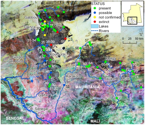
Figure 2. Distribution of crocodile localities along major river basins of southern Mauritania.
Dots represent localities where crocodiles are currently present (present), where presence is possible but needs confirmation (possible), where crocodiles were reported to be present but this study did not confirmed their presence (not confirmed) or where crocodiles went extinct (extinct). Easternmost known locality in Mauritania (locality 78) is only represented in small inset. Numbers refer to localities described in Table S2. Localities for Gabbou basin are shown in detail in Figure 3. Background is a composite Landsat image depicting land-cover.

