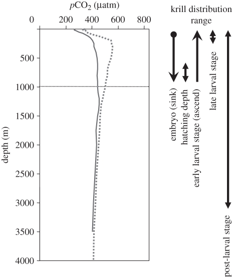
Figure 1.
Vertical distribution range of krill and pCO2 vertical profile at Scotia Sea (59–30° S, 47–30° W; thick line) and Weddell Sea (64–30° S, 34–30° W; dotted line), the known main krill habitats around the Antarctic. The values of pCO2 were calculated from DIC and TA (GLODAP: [20]), and in situ temperature and salinity [21] using the CO2SYS program [22] with silicate and phosphate contents set to zero. Data on krill depths from Quetin & Ross [6] (embryo); [23] (larvae); and [7] (post-larvae).

