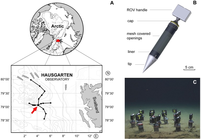
Figure 1. Location of the study area at the Arctic Marginal Ice Zone in the Fram Strait (Greenland Sea), west of Svalbard; a detailed design of the colonisation tubes and a close-up of the experimental site at 2475 m water depth.
A: Bathymetric map of the study area, with a dot at every HAUSGARTEN station. The arrow marks the central HAUSGARTEN station (HG IV) where the experiment was conducted. B: Colonisation tube design with indicative scale. C: The experimental plot at 2475 m water depth with randomly distributed colonisation tubes. Imagetaken by ROV Quest. Image copyright by MARUM, University of Bremen.

