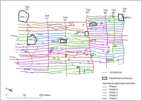
Fig. 6.
Map of the Kaiholena–Makeanehu area showing the relative chronology of agricultural alignments, trails, and residential enclosures as indicated by feature abutment. Suggested phases of construction are indicated by color. The division between the ahupua‘a of Kaiholena and Makeanehu is indicated by the BT1 trail. The extent of residential enclosure walls is indicated by dark borders; agricultural features are indicated by small polygons. See Fig. 2 for a LiDAR image of the same area.

