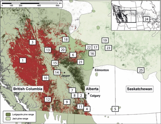
Fig. 1.

Sampling locations for lodgepole pine, jack pine and hybrids across western Canada analysed at 12 microsatellite loci. MPB attack data from 1958 to 2009 for British Columbia and from 1975 to 2009 for Alberta are indicated in red (Thandi & Taylor unpublished data), and approximate pine volume is shaded in green, where maximum densities are over 500 m3/ha (Yemshanov & McKenney unpublished data). Top-right inset of North America illustrates the location of the Ontario/Minnesota samples. Range distributions for jack pine and lodgepole pine were obtained from USGS (http://esp.cr.usgs.gov/data/atlas/little/, accessed 29 July 2010) and are based on Little (1971).
