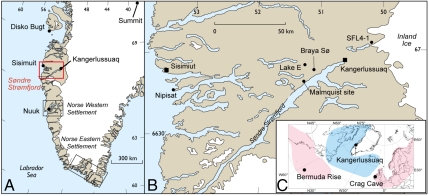
Fig. 1.
(A) Site map identifying Kangerlussuaq and other locations in West Greenland mentioned in the text. (B) Map of the Søndre Strømfjord region showing locations discussed in the text. (C) Map of the North Atlantic region noting the locations of Kangerlussuaq, Crag Cave (38), and the Bermuda Rise (39). Coloration indicates the modern temperature pattern observed during the positive mode of the North Atlantic Oscillation, where red is warm and blue is cool.

