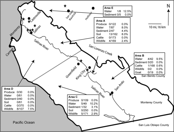
Fig. 1.
Map of Monterey County, CA, showing the Salinas River and the location of cities in the region. Areas of sampling (A to E) were assigned into sectors, with the dashed line signifying the separation between the north and south and the Salinas River being the border between the east and west in Monterey County. Some samples were taken in the northwest of San Benito County (area E). The public access sites where samples yielded positive Salmonella isolates from water collected on public lands are designated by a star. These sites are noted in Table 4. The arrows pointing to areas A to E are not specific to a particular sampling site.

