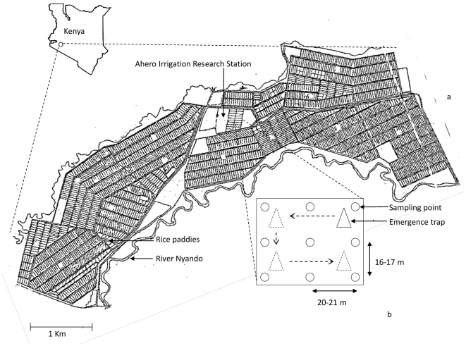
Figure 1. Ahero Irrigation scheme, sampling points for area sampler and emergence trap.
Layout of rice paddies (1 acre each) in the Ahero Irrigation scheme (total area 2,168 acres) and location of the scheme in Kenya. The Ahero Irrigation Research Station (AIRS) is located within the scheme. The river Nyando is the water source for the scheme. a: Sketch of the entire scheme (courtesy of AIRS) and b: Schematic diagram showing the nine sampling points for the area sampler in a rice paddy, the emergence trap and the positions to which the emergence trap was moved.

