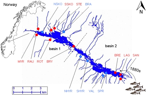
Figure 1.
The Lesjaskogsvatnet lake system (elevation 411 m above sea level, area 4.52 km2) in mid Norway (after Gregersen et al. 2008). It contains two major outlets draining into two of the largest Norwegian rivers, the river Gudbrandsdalslågen in the south and the river Rauma in the north. The dashed line indicates the two basins, basin 1 north and basin 2 south, separated by distinct stream-like straits. Sampling locations are abbreviated and labeled in blue for ‘cold' and red for ‘warm' (see Table 1). For more details of the lake system see Gregersen et al. (2008).

