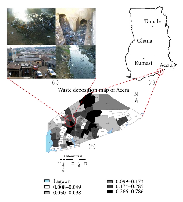
Figure 1.

Map of the study area, Accra, Ghana. (a) is the map of Ghana showing the geographic position of Accra. (b) Shows the 70 census clusters which were used as the units of analysis. (c) Shows the amplification of the neighbourhood environmental conditions (i.e., uncontrolled solid waste incineration, choked open drain, stagnant water in an open drain, and dilapidated housing conditions) as pertain in the census clusters.
