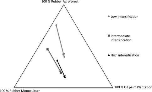
Fig. 12.
Perceptions among Bungo residents of the proportions of the three main land uses in their village territory, at present (beginning of the arrows) and in 20 years (end of the arrows). Results were averaged and clustered in 3 categories of 4 villages, Lubuk Beringin is in the “low”, Tebing Tinggi in the “intermediate” and Danau in the high intensification category. Adapted from Therville 2008, based on a survey of 12 villages in Bungo District

