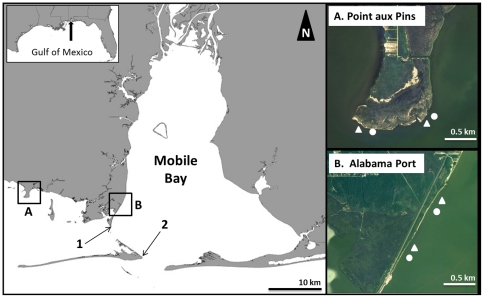
Figure 2. Map of Study Sites in Mobile Bay and Mississippi Sound, Alabama.
White triangles represent breakwater reef complexes and white circles represent control treatments at the two restoration sites of (A) Point aux Pins and (B) Alabama Port. The locations of the (1) Cedar Point and (2) Dauphin Island hydrographic monitoring stations are denoted by the numbered arrows.

