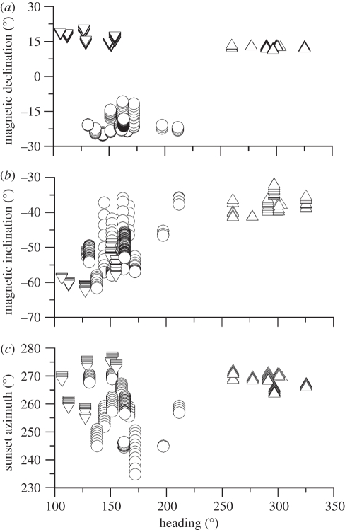
Figure 2.
(a) Magnetic declination, (b) magnetic inclination, and (c) sunset azimuth plotted against constant course segment heading for each of the three low-latitude tagging areas studied. Magnetic coordinates and Sun azimuths were calculated at the time and location of individual whales using the methods described in the text. Circles, Brazil; triangles, Rarotonga; inverted triangles, New Caledonia.

