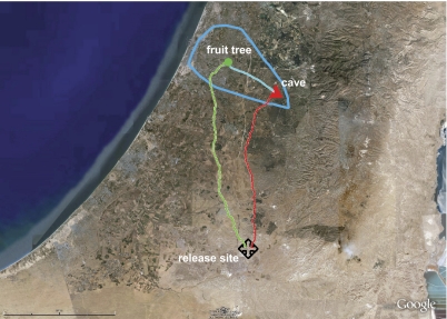
Fig. 1.
Google Earth map showing straight return paths of bats released far outside their familiar foraging area (+, release location). Blue line indicates the boundaries of the area where the bats were known to forage. Red and green lines indicate tracked trajectories to foraging site and cave, respectively.

