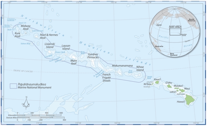
Figure 1. Map of the Hawaiian Archipelago, comprised of the inhabited high islands of the main Hawaiian Islands (from Kaua‘i/Ni‘ihau to Hawai‘i Island) and the uninhabited reefs, banks, and atolls of the Northwestern Hawaiian Islands (NWHI).
The boundary for the Papahānaumokuākea Marine National Monument in the NWHI is indicated in black. Map courtesy of the NOAA Papahānaumokuākea Marine National Monument Office.

