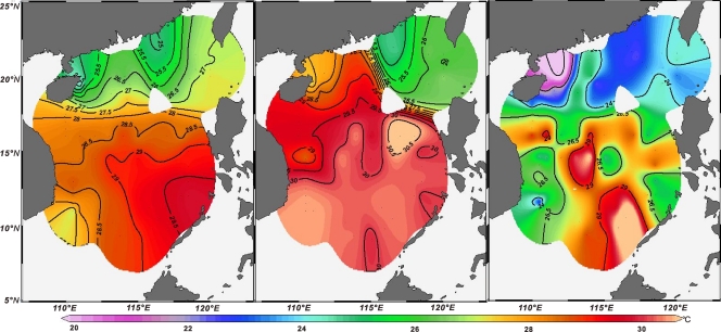
Fig. 5.
Maps of satellite-based average sea surface temperatures for the April-May season during which the surface water samples were collected (left), in situ temperatures determined from CTD (middle), and TEX86-based temperatures of surface water samples according to reference 32. (Maps generated with Ocean Data View software.)

