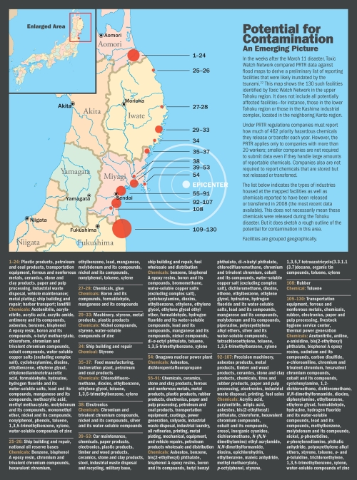
Potential for Contamination: An Emerging Picture.
In the weeks after the March 11 disaster, Toxic Watch Network compared PRTR data against flood maps to derive a preliminary list of reporting facilities that were likely inundated by the tsunami.22 This map shows the 130 such facilities identified by Toxic Watch Network in the upper Tohoku region. It does not include all potentially affected facilities—for instance, those in the lower Tohoku region or those in the Kashima industrial complex, located in the neighboring Kanto region.

