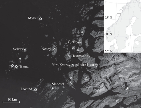
Figure 1.
The house sparrow metapopulation study system on the coast of Norway (66° N, 13° E). The 18 study islands are marked with either a triangle (island with cattle farms) or a circle (islands without farms). The farm islands are assumed to represent superior habitat for the house sparrows, whereas the non-farm islands represent inferior habitat. The nine natal populations included in this study are labelled with the island name. Temperature data were collected from a weather station on the study island Myken (not included as natal population, but indicated with name).

