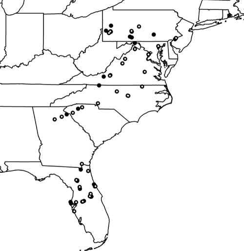
Fig. 7.
Generalized schematic map showing 57 collection areas (black dots) containing buildings yielding Fusarium. White points within black dots highlight sites that yielded the widespread clonal lineage FOSC ST 33. Buildings <10 miles apart were grouped into 57 “sites” for depiction using ArcMap 9.2 (Esri, Redlands, CA) and layers downloaded from the U.S. Census Bureau (http://www.census.gov/geo/www/cob/st2000.html).

