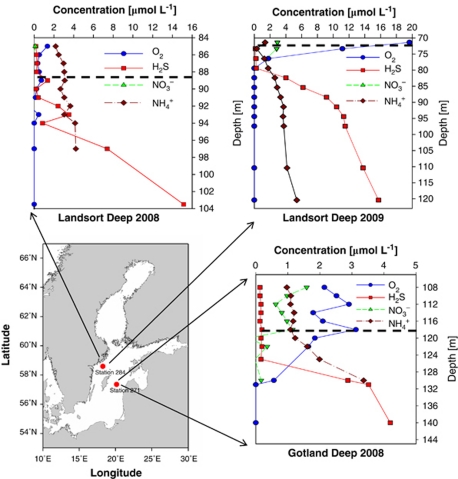
Figure 1.
Map of the central Baltic Sea including chemical profiles of the investigated pelagic redoxclines. Red dots indicate the positions of sampling stations 284 (Landsort Deep, 58°35.00′N, 18°14.06′E) and 271 (Gotland Deep, 57°19.89′N, 20°10.28′E). Embedded graphs present chemical data recorded during sampling in August 2008 and September 2009. The dashed line marks the sampling depths: 118 m (Gotland Deep 2008), 89 m (Landsort Deep 2008) and 72 m (Landsort Deep 2009). Data source for the map: Seifert T, Tauber F, Kayser B (2001). A High Resolution Spherical Grid Topography of the Baltic Sea (Revised Edition). Baltic Sea Science Conference, 25–29 November 2001; Stockholm. Poster #147 (http://www.io-warnemuende.de/iowtopo).

