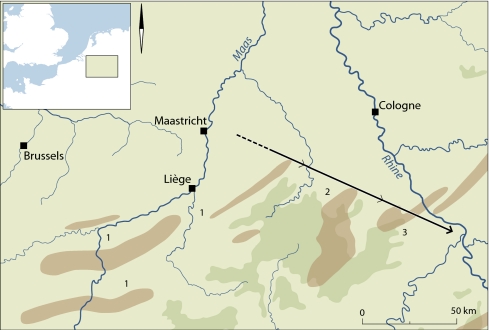
Fig. 5.
Map indicating the location of Maastricht (-Belvédère) and the Ardennes iron ore sources (in red) of the Liège-Dinant-Namur area (1) as well as the Eifel sources (2, 3) (modified after ref. 33). The arrow indicates the transfer of flint artifacts from the Maastricht Cretaceous chalk area to the East Eifel sites of Wannen and Schweinskopf, as discussed in the text. Terrain >500 m above sea level is indicated in dark green.

