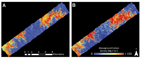
Figure 6.
Comparison of (A) median ACD applied to one southern humid forest landscape according to the final regional, satellite-based stratification, and (B) direct mapping of ACD using airborne LiDAR with the MCH-to-ACD model from Figure 2. The colors, image stretch, and units are the same in both images.

