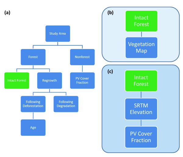
Figure 9.
Stepwise pathways used to stratify each study region: (a) Forest cover and regrowth mapping with multi-temporal Landsat imagery in CLASlite; (b) Combining CLASlite outputs from (a) and a classified vegetation map for regional pre-flight stratification to direct airborne LiDAR sampling; (c) Combining CLASlite outputs from (a) and elevation from the NASA Shuttle Radar Topography Mission (SRTM) in final regional stratification to capture regional ACD variation.

