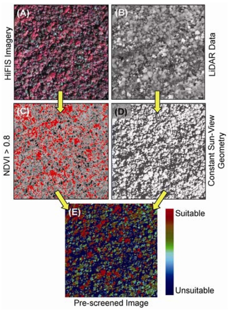
Figure 4.
Fully integrated (A) hyperspectral and (B) LiDAR instrumentation provides a means to filter rainforest canopies into comparable units for mapping invasive species. (C) Simple pre-screening of the data based on a minimum NDVI, here set to 0.8, ensures that only foliated canopies are analyzed (red color). (D) Sun-target-view geometry (here, 20°) and minimum canopy height (here, 5 m) is controlled for using the LiDAR data thus pre-screening for view angle effects (white color). (E) Combined, these filters provide a map of canopies suitable for species determinations and comparison. These example images were collected over a Hawaiian rainforest reserve. Adapted from Asner and Martin [77] with permission from Elsevier.

