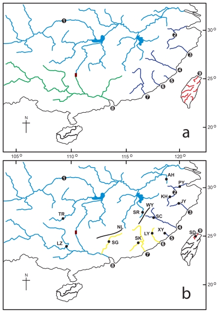
Figure 1.
Maps showing (a) four sub-districts proposed by Li [3]. The Pearl River Subdistrict in green, ZheMin Sub-district in purple, Taiwan Sub-district in red, Kiang-Husi Sub-district in blue, and the Lingqu Canal connecting the Yangtze and Pearl Rivers in brown; 1 = Yangtze River, 2 = Qiantang River, 3 = Oujiang, 4 = Minjiang River, 5 = Mulan River, 6 = Jiulong River, 7 = Hanjiang, 8 = Pearl River, 9 = Tamsui River; (b) thirteen sampling sites of Squalidus argentatus and four units of samples based on SAMOVA analysis: Yangtze-Pearl group (in blue), Qiantang-Minjiang group (in purple), Jiulong-Beijiang group (in yellow), and Taiwan group (in red). See Table 1 for details of sampling sites. The bold lines indicate roughly the Wuyi (WY) and Nanling Mountains (NL).

